Star Vision Limited (SVL) developed AI artificial intelligence solution for solar photovoltaic (PV) panel search.
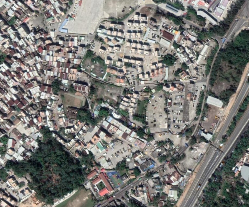
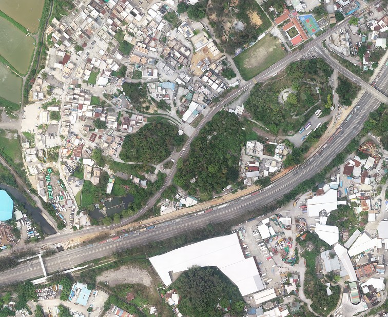
The following is a SVL satellite image in San Tin area at 0.3m resolution, where PV panels can be seen. SVL supplies commercial global satellite images captured at 100 km above ground, with image resolution down to 0.3 m.
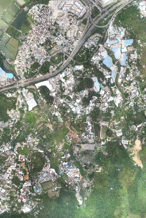
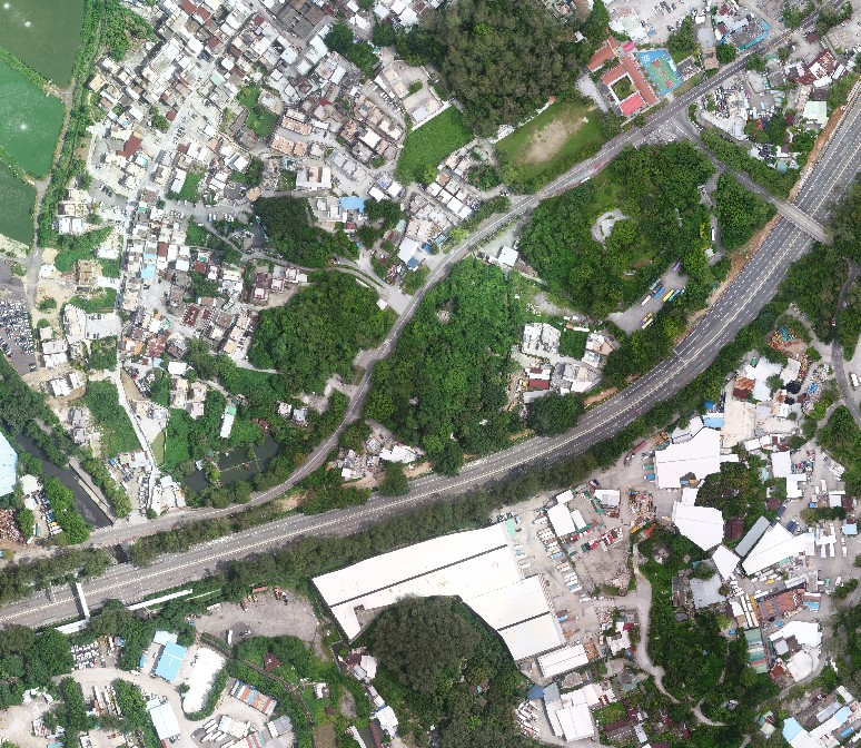
The following is a SVL higher-resolution drone image map of the same location. Drone image map uses thousands of high-altitude images to form corrected images without distortion. The precise and correct position of the drone image map is determined by professional GNSS, more advanced than GPS, at 1 cm accuracy. The SVL image map consists of precise HK local 1980 grid coordinates, which matches with government official digital map within few cm level.
SVL drone image map can update old digital map.
PV panel can be extracted from the drone image map.
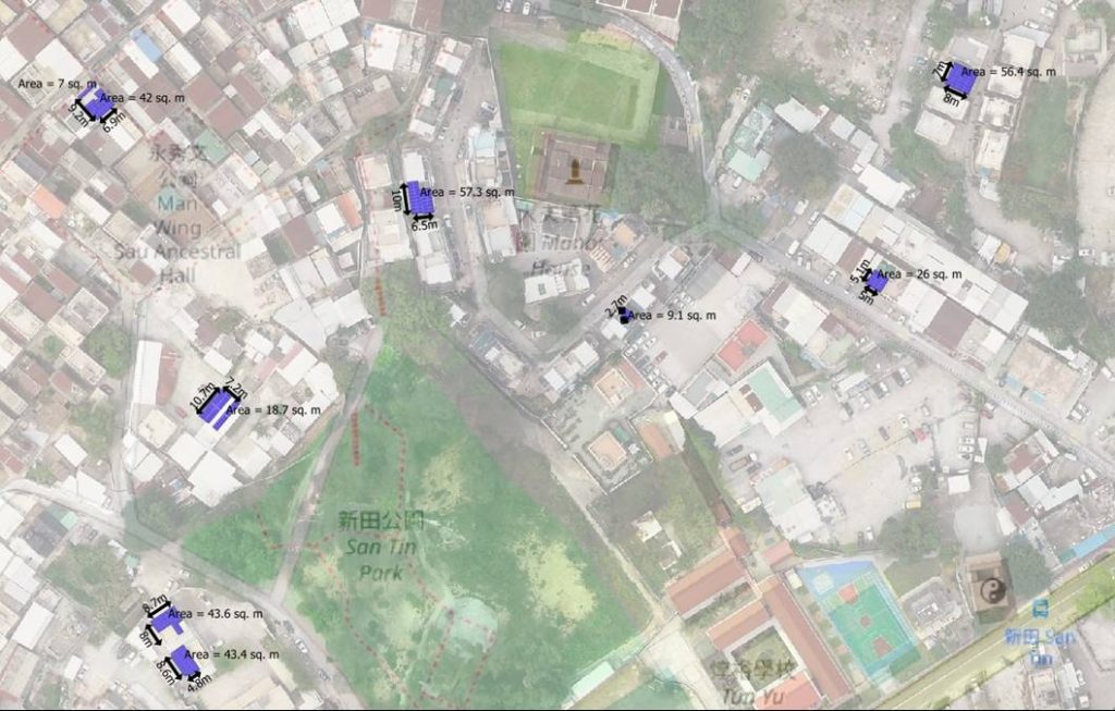
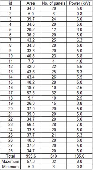
SVL Vision System contains GIS database of the most updated PV panel distribution per small house, PV area in sq. m, estimated power in kW, and estimated dimension, at 0.1 m resolution.