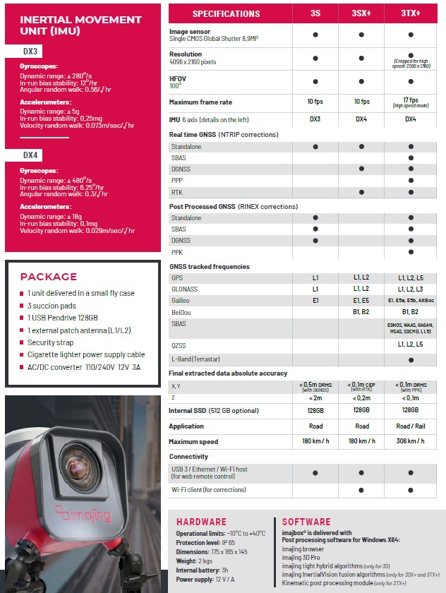
Key Features
Image-based Mobile Mapping System
- High speed, high definition street view photo
- Photo resolution: 4096 x 2160 pixels
- Maximum frame rate:
- 10 fps (full resolution)
- 17 fps (high speed mode)
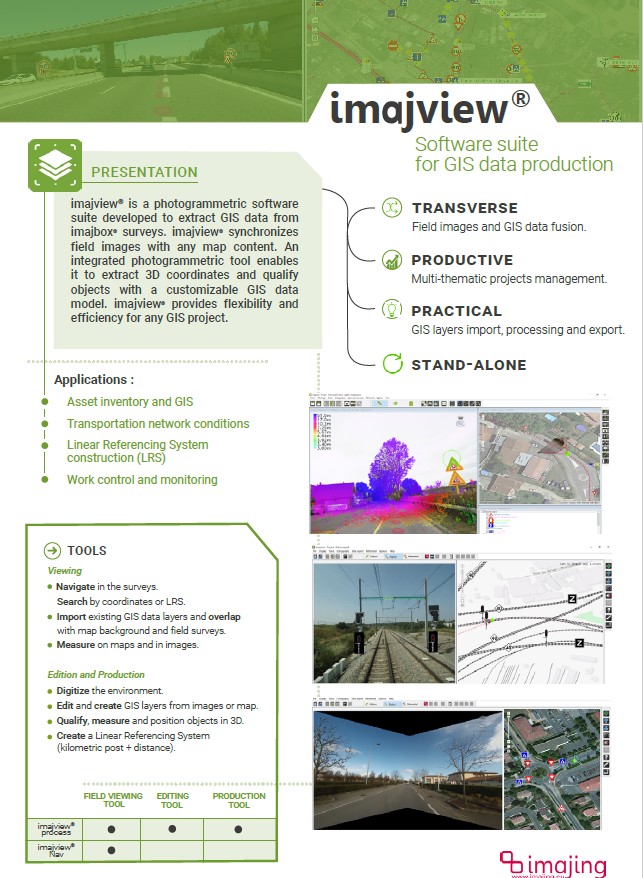
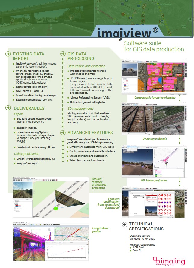
GIS Production
- Come with photogrammetric software suite to extract GIS data
Adjustable and Versatile
- Easily mounted in every orientations with the tripod’s succion pads
- Easily mounted on cars, trucks, trains or boats
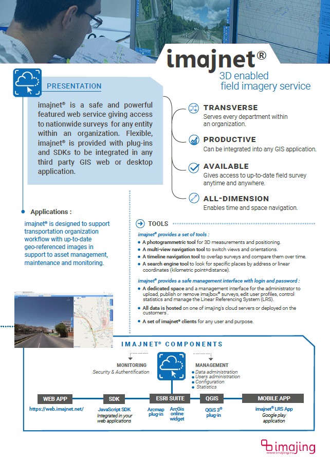
Web Service
- High flexibility with plug-ins and SDKs
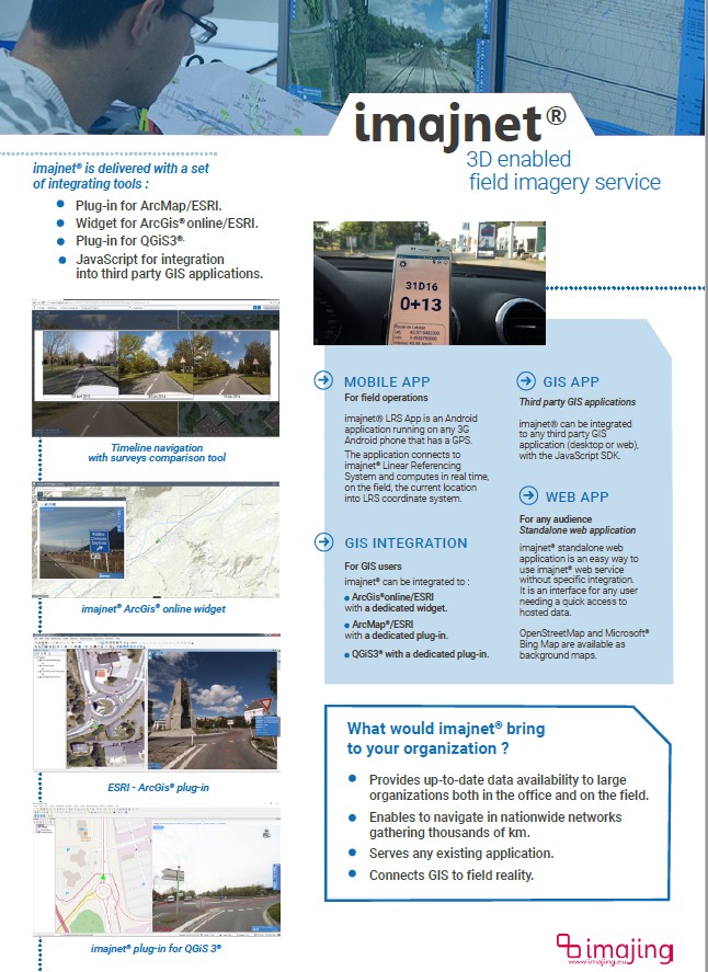
Three tools provided by Imajing that provide integrated workflow from image data collection to map and geographical information system (GIS) generation:
- Imajbox (Sensor)
- Imajview (GIS Software)
- Imajnet (Web Service)
Imajbox
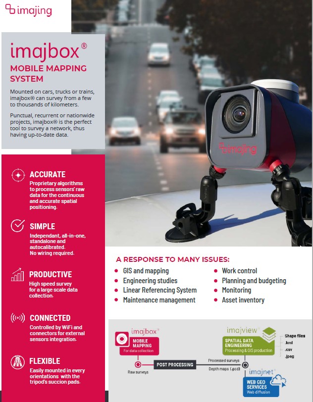
Imajview
Imajnet
Keywords: Mobile Mapping System, Image, Vehicle, Rail, GNSS, IMU, 2D GIS, 3D GIS

