Skip to content
About Us
About Us
關於我們
关于我们
私たちについて
Our Managing Director
Services
Remote Sensing
Aerial Survey by Photogrammetry
Laser Scanning
Space Technology
Topographic
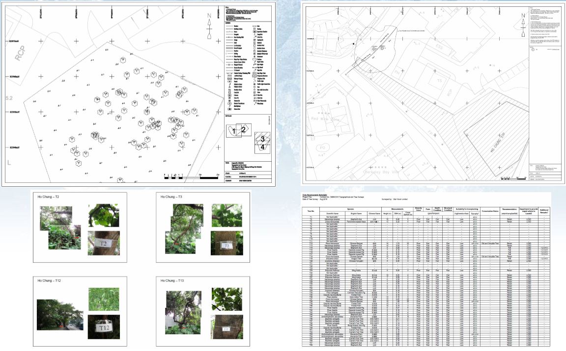
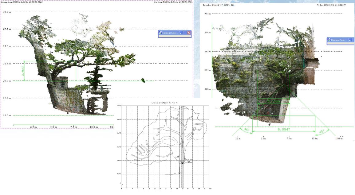
Tree Survey
Topographic Survey
GIS
GIS Applications
Geospatial Data Management System (GDMS) Service
Cadastral/ Land Boundary Survey
Expert Witness for Lot Boundary Disputes and Adverse Possession
Condition Survey
Others
Environmental Impact Assessment
Site Selection (Feng Shui)
3D Showcases
Sunlight and Shadow Simulator
Products
Hardware and Software
Software
Agisoft Metashape
Aplitop
Geostory GeoModeler
Global Mapper
Quick Terrain Modeler (QTM)
RealityCapture
Supergeo SuperGIS
UgCS Command & Control
UgCS – Drone Based Solutions for Industrial Inspections
Hardware
(NEW) GNSS Tracker – Safeguard Your Journey, Unleash Your Adventure
OmniSLAM Mobile SLAM Color 3D Laser Scanner
(NEW) CHCNAV Android-powered Total Station
CHCNAV Alpha3D Mobile Mapping System
(NEW) SOKKIA iX Robotic Total Station
(NEW) SingularXYZ Lightweight GNSS Receivers
(NEW) GPSPATRON GNSS Interference Detection Device
Autel Robotics
Emesent Hovermap
Imajing
SV-Map Image Projects
3D Urban Model
SV-Image
SVMap – Image versus Google Map
News
星期日檔案 穿山入林
Star Vision in Solomon Islands: Mapping and Zoning of Demonstration Land/Seascapes for UNDP
星眺與所羅門群島:為聯合國開發計劃署進行示範陸地/海洋景觀的測繪與分區製圖
Mr. Thomas Lee Presents at EEHB 2024
Paper Published on HKIE Transactions
無人機協助搜索失蹤人士
土地測量師測量繪地圖30年 用專業知識助搜索行山失蹤者【附行山11個注意事項】
TVB創科導航 無人機睇風水
RTHK Hong Kong Connection(鏗鏘集) 尋人啟示
Contact Us
Search for:
Toggle sidebar & navigation
Tree Survey
Tree Survey
Scroll to top
error:
Content is protected !!