![]()
ADVANCED 3D SURVEYING SYSTEMSSABRE ADVANCED 3D, design, develop and manufacture standalone and fully integrated mobile 3D Geospatial data acquisition product solutions using LiDAR (Light Detection And Ranging) and camera solutions for mobile mapping.
We offer standard and custom equipment solutions for deployment on mobile, ground, marine, airborne platforms or any appropriate mobile platform.
Our typical clients are surveying and inspection industry service companies, covering utility mapping, roads and highways, Geospatial, GIS/Geomatics, mining, Oil&Gas, among many others.
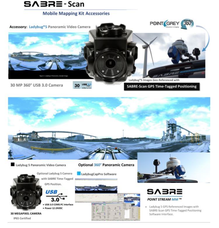
Georeferenced Imagery Solutions Avialable. Above Ladybug5 Panoramic (360) Video Camera Plug and Play with the SABRE-SCAN mobile mapping product. The Ladybug5 uses machine vision camera global shutter type camera lens which mitigate motion blur for image capture from a moving vehicle/platform. Please ask for other avilable solutions, email info@starvision.com.hk
SABRE SKY-3D UAV LiDAR – Remote Sensor Payloads
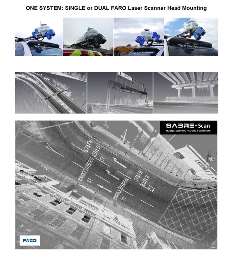
The SABRE UAV LiDAR presently uses either any range of FARO Focus3D or SABRE S80 model laser with a single-beam which is accurately calibrated, delivering survey-grade results.
UAV LiDAR – A View from Above – Advantageous airborne operated LiDAR
Airborne LiDAR systems offer Rapid survey of areas within difficult, inaccessible or dangerous situations for ground-based survey.
Mounting of LiDAR systems on Drone Platforms provides enhanced results with the coverage being improved by the Line-Of-Sight. This is achieved by having a high-angled view-point from above reducing blind-spot areas when compared against the view-point seen from ground level using conventionally operated vehicle mounted LiDAR systems. The perspective of data acquisition at height also maximises the range capabilities of the utilised laser using a more ideal perpendicular angle of incidence encountered by the laser-beam.
SABRE’s Aerial LiDAR product – high-definition SKY-3D FARO Focus 3D
The screen-capture’s below show the detail captured using the SABRE Sky-3D S120 for quarry and stockpile assessment. The airborne UAV LiDAR captured point clouds show the enhanced coverage capabilities of scanning from a 30m flying altitude.
SABRE SKY-3D S80 – light-weight vegetation and forest canopy penetrating LiDAR
The SABRE S80 laser is a lighter-weight laser more suited to penetration of vegetation and forest canopy that produces ~58K Points per second.
The SABRE S80 laser has 5 hits/returns typical distance range up to 80 metres. The Screen shot below shows the ability of the time-of-flight laser to penetrate forest tree canopy.

